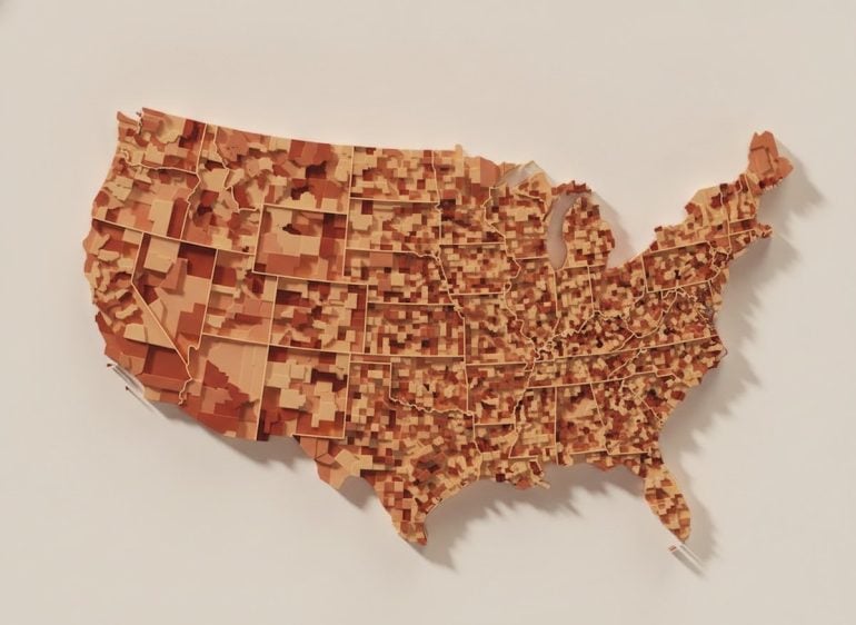
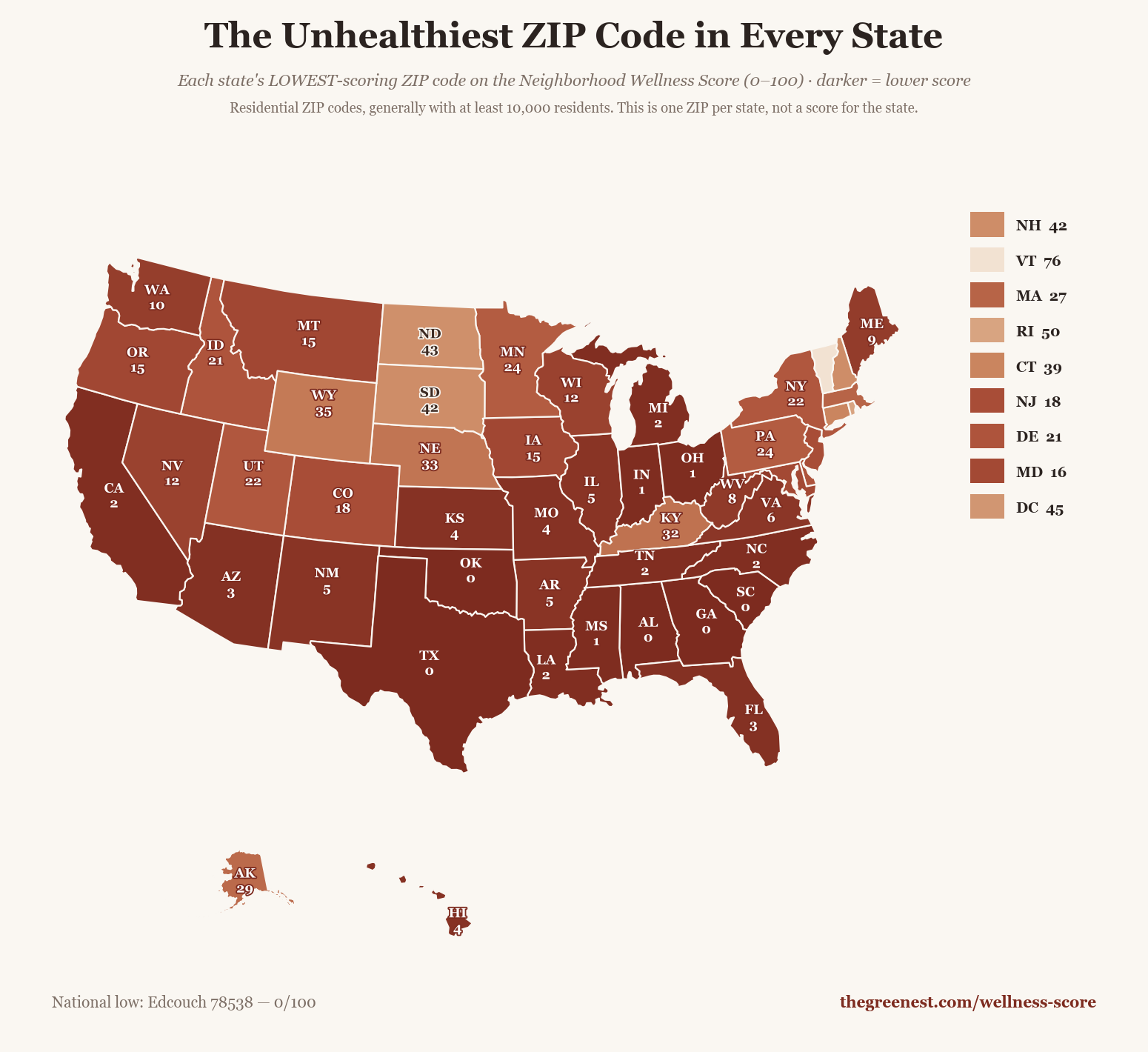
We analyzed our Neighborhood Wellness Scores across 18,357 ZIP codes to find the unhealthiest ZIP code in every state.
Your ZIP code is doing something to your health whether you asked it to or not. The World Health Organization puts 30 to 55 percent of health outcomes down to where and how you live: what food is close by, what the air outside your door is like, whether the sidewalks actually go anywhere.
A while back we found the healthiest ZIP code in every state. The obvious next question was the other end of the scale. So: using the same Neighborhood Wellness Score across all 18,356 U.S. ZIP codes we can score, here is the lowest-scoring one in each state, generally with at least 10,000 people in it.
Nobody on this list is doing anything wrong. These are just the places where the stuff that makes being healthy easy is furthest away. The grocery store that closed and never came back. The clinic two towns over. Air that carries a little more than it should.
Scores run 0 to 100 and they are national percentiles: a 30 means the ZIP scores below 70 percent of the country. Five states on this list bottom out at 0. Find your state, then go check your own ZIP and see whether you get to feel smug about it.
A few states got off easy. Vermont’s lowest-scoring ZIP still reads 76 out of 100 — the state has no neighborhood that scores badly at all. Rhode Island, D.C., the Dakotas and New Hampshire all bottom out above 40. Congratulations, sort of.
How to read the scores: The big number on each card is the ZIP’s national percentile on the merged Wellness Score — the same number the tool shows. Underneath it, each ZIP is rated 0 to 100 across five dimensions. Health outcomes measures chronic disease rates and preventable hospitalizations. A low score means residents here carry some of the heaviest chronic disease burden in the country. Food access reflects grocery density and proximity, weighed against fast food and convenience stores. Movement covers parks, bike lanes, and fitness facilities. Environment reflects air and water quality. Healthcare access measures clinic presence and coverage rates.
How to read each card
28/100
Overall wellness score
Below 30 Fewest resources
30–39 Well below average
40–49 Below average
50 and up Near the national middle
🥦 FoodGrocery access and healthy-to-fast-food ratio
🏃 MovementParks, walkability, and fitness access
🌿 EnvironmentAir quality and water safety
❤️ HealthChronic disease and hospitalization rates
🏥 HealthcareClinic access and coverage rates
The Unhealthiest ZIP Code in Every State
The lowest-scoring ZIP code in all 50 states and Washington D.C., generally with at least 10,000 residents, measured across food access, walkability, air quality, healthcare access, and health outcomes. Sorted alphabetically by state.
0/100
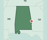
Alabama
Phenix CityZIP 36869
#75 unhealthiest ZIP code in America of 18,356
🥦 Food 45🏃 Movement 32🌿 Environment 25❤️ Health 7🏥 Healthcare 24
Phenix City is the rare card with no redeeming column: all five measures land under Alabama’s own median, in a state whose median is already low. Environment reads 24.8 against 66.0 and healthcare access 23.8 against 50.0. Health outcomes, at 6.7, sit near the floor of a state that has plenty of company down there.
→Environment 24.8 against an Alabama median of 66.0 — the steepest single gap on this card
→Healthcare access 23.8, less than half the state median of 50.0
→No bright spot: every one of the five measures sits below Alabama’s median. Food access, at 44.9 against 50.0, comes closest
One more thing about Phenix CityIn 1954 Phenix City was so completely run by gambling syndicates that when Albert Patterson won the Democratic nomination for state attorney general on a promise to clean it up, he was shot dead in the parking lot beside his law office. The governor placed Russell County under martial law five weeks later. Patterson had predicted the cleanup would take ten years. It took about seven months.Source: Encyclopedia of Alabama
🥦 Food 82🏃 Movement 43🌿 Environment 99❤️ Health 63🏥 Healthcare 57
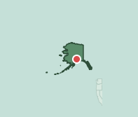
Wasilla is Alaska’s lowest merged score and still lands at 29 — the state’s floor is high because so little of it is polluted. Environment reads 99.2 and food access 81.7, both far above the Alaska median. What pulls it down is health outcomes at 63.3 against 73.6, and walkability at 42.7 in a town built for driving.
→Health outcomes 63.3 against an Alaska median of 73.6 — the measure that decides this card
→Walkability 42.7, under the state median of 50.0
→Working in its favor: food access 81.7 against a median of 55.0, and environment 99.2 — the highest on this list
One more thing about WasillaWasilla exists because in 1917 the Alaska Railroad crossed the wagon road running up to the Willow Creek mines, and a government land auction put a town at the junction. It is now the headquarters of the Iditarod. The race was co-founded by Dorothy Page, a Wasilla museum volunteer who is still called the Mother of the Iditarod.Source: City of Wasilla / Travel Alaska
🥦 Food 41🏃 Movement 28🌿 Environment 98❤️ Health 17🏥 Healthcare 24
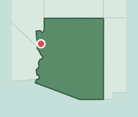
Golden Valley has one of the cleanest environment scores on this list and almost nothing else. Environment reads 98.5 against an Arizona median of 51.5. Health outcomes read 16.9 against 66.2, healthcare access 23.7 against 53.7, walkability 27.6 against 55.4 — a desert exurb where the nearest of anything is a drive.
→Health outcomes 16.9 against an Arizona median of 66.2 — a 49-point gap
→Healthcare access 23.7 and walkability 27.6, each roughly half the state median
→Working in its favor: environment 98.5 against a state median of 51.5. Clean air is the one thing this ZIP has in abundance
One more thing about Golden ValleyGolden Valley was not so much founded as sold. In the 1970s a Hollywood development company carved the desert south of State Route 68 into 2.5-acre parcels and advertised them at $695 apiece — ten dollars down, ten dollars a month. People bought them sight unseen. The result is a community spread across the Sacramento Valley with no real center to it.Source: Mohave County / Golden Valley community profile
See why your ZIP code is better than Golden Valley
🥦 Food 54🏃 Movement 33🌿 Environment 75❤️ Health 1🏥 Healthcare 51
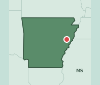
Forrest City posts a health outcomes score of 1.2 — close to the national floor — in a state whose own median is only 15.5. Food access is genuinely decent at 54.3 against 40.9, and healthcare access sits just above the state median. The chronic disease picture is doing all the damage here.
→Health outcomes 1.2, against an Arkansas median that is itself only 15.5
→Walkability 33.3, under the state median of 40.0
→Working in its favor: food access 54.3 against a state median of 40.9 — better grocery access than most of Arkansas
One more thing about Forrest CityThe town is named for Nathan Bedford Forrest, who camped here in 1866 with about a thousand workmen cutting the Memphis and Little Rock Railroad through Crowley’s Ridge. He was a Confederate general and later the first Grand Wizard of the Ku Klux Klan. The town incorporated under his name in 1870 and has carried it ever since.Source: Encyclopedia of Arkansas / Arkansas Democrat-Gazette
🥦 Food 62🏃 Movement 29🌿 Environment 7❤️ Health 15🏥 Healthcare 45
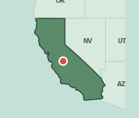
Chowchilla sits in the Central Valley and carries two of the Valley’s signature problems at once. Environment reads 7.2 against a California median of 50.9 — the lowest environment score on this list — and health outcomes 14.6 against 70.4. That 55.8-point health gap is among the widest between any pick and its own state here.
→Health outcomes 14.6 against a California median of 70.4 — a 55.8-point gap
→Environment 7.2, the lowest on this list, against a state median of 50.9
→Working in its favor: food access 61.6 against a California median of 55.0 — the only measure that clears the state
One more thing about ChowchillaOn 15 July 1976 three men stopped a Chowchilla school bus, took twenty-six children and their driver, Ed Ray, and buried them in a moving van in a quarry a hundred miles away. Ray and the older children dug their way out after sixteen hours. All twenty-seven came home. A granite monument beside the police station marks where they were returned to their families.Source: City of Chowchilla / CBS News
🥦 Food 16🏃 Movement 43🌿 Environment 55❤️ Health 50🏥 Healthcare 57
Fort Lupton is a farm town north of Denver, and its food access score of 16.0 against a Colorado median of 50.0 is the story of the card. Health outcomes read 49.7 where the state’s median ZIP posts 86.9 — a middling number that looks far worse next to Colorado than it would almost anywhere else.
→Food access 16.0 against a Colorado median of 50.0 — under a third of the state’s typical score
→Health outcomes 49.7 against a state median of 86.9, a 37-point gap
→Working in its favor: healthcare access 56.7, modestly above the Colorado median of 52.9
One more thing about Fort LuptonThe town began as Fort Lancaster, an adobe trading post that Lancaster Lupton built on the South Platte in 1836 after resigning from the Army. He brought craftsmen up from Taos to raise walls eighteen feet high, traded with the Cheyenne and Arapaho for eight years, then lost the place to a blizzard in 1844. A reconstruction stands a short distance from the original site.Source: Weld County history / Legends of America
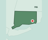
🥦 Food 54🏃 Movement 65🌿 Environment 25❤️ Health 58🏥 Healthcare 62
Uncasville is Connecticut’s lowest merged score and it still reads 39, which says more about Connecticut than about Uncasville. Health outcomes at 57.8 against a state median of 84.5 is the only real gap. Walkability, healthcare access and food access all clear the state; environment sits exactly at Connecticut’s median of 25.0, which is low for everyone there.
→Health outcomes 57.8 against a Connecticut median of 84.5 — effectively the whole gap
→Environment 25.0, exactly the state median. Connecticut scores poorly on this measure statewide
→Working in its favor: walkability 64.7 and healthcare access 62.4, both above the state medians of 56.3 and 55.8
One more thing about UncasvilleThe village is named for Uncas, the seventeenth-century Mohegan sachem whose name comes from Wonkus, meaning fox. It is also home to the Tantaquidgeon Museum, opened in 1931 by the Mohegan medicine woman and anthropologist Gladys Tantaquidgeon and two of her relatives — the oldest museum in the country owned and run by a Native American tribe.Source: Tantaquidgeon Museum / The Mohegan Tribe
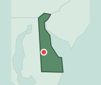
🥦 Food 58🏃 Movement 49🌿 Environment 77❤️ Health 26🏥 Healthcare 44
Harrington sits in Kent County farmland and posts an environment score of 77.3 against a Delaware median of 29.8 — the biggest positive gap of any pick on this list. It does not save the card. Health outcomes read 26.4 against 50.0, and both walkability and healthcare access land under the state.
→Health outcomes 26.4, roughly half the Delaware median of 50.0
→Walkability 49.0 and healthcare access 44.1, both under the state medians of 59.9 and 52.8
→Working in its favor: environment 77.3 against a Delaware median of 29.8 — the largest single advantage over a state median anywhere on this list
One more thing about HarringtonHarrington has held a harness racing meet every single year since 1946, when a group of enthusiasts ran a sixty-day fairground season and then built themselves a proper track. It sits on the Delaware State Fair grounds and is one of the oldest continuously operating racetracks in the country.Source: Harrington Raceway / Delaware State Fair
🥦 Food 38🏃 Movement 80🌿 Environment 66❤️ Health 35🏥 Healthcare 64
Ward 7, east of the Anacostia, carries the widest health gap on this list: health outcomes 34.6 against a District median of 98.8. Food access is 37.8 where the rest of D.C. posts 83.5 — also the widest food gap here. It is a walkable ZIP, 80.2, in a city where walkability is not the thing that is missing.
→Health outcomes 34.6 against a District median of 98.8 — the widest gap between any pick and its own state on this list
→Food access 37.8 against 83.5, the widest food gap on this list
→Working in its favor: walkability 80.2, only just under the District median of 82.9
One more thing about WashingtonThe long green strip running through this part of Ward 7 was Watts Branch Park, and in the 1970s people called it Needle Park. Volunteers spent five years cleaning it up, and on what would have been Marvin Gaye’s 67th birthday in 2006 it was rededicated in his name. It is the longest municipal park in Washington.Source: DC Office of the Deputy Mayor / NRPA
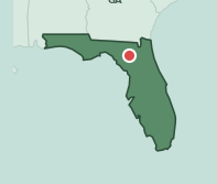
🥦 Food 44🏃 Movement 38🌿 Environment 69❤️ Health 25🏥 Healthcare 24
Fort White is rural Columbia County, and healthcare access is the sharpest problem: 23.9 against a Florida median of 58.0, the widest healthcare gap on this list. Health outcomes track close behind at 24.7 against 57.8. Environment clears the state at 68.8, but nearly everything a person needs to reach is far away.
→Healthcare access 23.9 against a Florida median of 58.0 — the widest healthcare gap on this list
→Health outcomes 24.7 against 57.8, and food access 44.5 against 59.3
→Working in its favor: environment 68.8, above the Florida median of 59.4
One more thing about Fort WhiteFort White is named for an army fort thrown up in the 1830s, and incorporated in 1870 when this was still frontier. A second town, Ichetucknee, grew up nearby on the spring run and had its own post office, grist mill and smithy by 1884. Hurricanes, hard winters and the boll weevil finished it off. The springs are now a state park.Source: Florida State Parks / Visit Natural North Florida
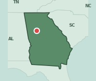
🥦 Food 49🏃 Movement 44🌿 Environment 16❤️ Health 13🏥 Healthcare 24
Jonesboro scores 0, and environment is why: 16.0 against a Georgia median of 75.0, a 59-point gap. Healthcare access follows at 24.0 against 50.0. Health outcomes, 12.9, are about a third of the state median. At 41,617 residents it is one of the largest ZIP codes on this list.
→Environment 16.0 against a Georgia median of 75.0 — a 59-point gap
→Healthcare access 24.0, less than half the state median of 50.0
→Barely a bright spot: walkability 43.7 and food access 48.6 clear the Georgia medians of 39.8 and 48.4, but only just
One more thing about JonesboroMargaret Mitchell put Tara five miles from Jonesboro, and she did not pick the spot at random — her grandmother was born and raised on a Clayton County plantation that became the model for it. The town was also the site of the 1864 Battle of Jonesboro, which cut the last railway into Atlanta and forced the city’s evacuation.Source: New Georgia Encyclopedia / Explore Georgia
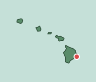
🥦 Food 48🏃 Movement 41🌿 Environment 98❤️ Health 18🏥 Healthcare 44
Pahoa sits in the Puna district on the flank of Kilauea, and the number that matters is health outcomes: 18.5 against a Hawaii median of 75.1, a 56.6-point gap. Environment scores 98.1, but so does most of Hawaii — the state median is 95.7. Clean air here is the baseline, not an advantage.
→Health outcomes 18.5 against a Hawaii median of 75.1 — a 56.6-point gap
→Walkability 41.0, food access 48.4 and healthcare access 44.3 all sit under the state medians
→Barely a bright spot: environment 98.1, against a Hawaii median of 95.7. Nearly every ZIP in the state scores this well
One more thing about PahoaIn 2018 Kilauea opened fissures in the subdivisions just outside Pahoa and did not stop for three months. It destroyed 723 structures, 612 of them homes, buried 13.7 square miles, and added 875 acres of brand-new land to the island. The Pahoa Community Center became a Red Cross shelter.Source: Hawaii County Recovery / USGS
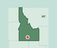
🥦 Food 73🏃 Movement 61🌿 Environment 75❤️ Health 45🏥 Healthcare 50
Jerome is a Magic Valley farm town and an unusual card: food access 73.0 and walkability 61.2 both clear the Idaho medians comfortably, and healthcare access and environment sit exactly at them. Health outcomes, 44.6 against 65.3, are the only measure pulling down — which is why the badge is 21 rather than single digits.
→Health outcomes 44.6 against an Idaho median of 65.3 — the only measure below the state
→Healthcare access 50.1 and environment 75.0, both exactly at the Idaho median
→Working in its favor: food access 73.0 against a state median of 50.0, and walkability 61.2 against 49.8
One more thing about JeromeThe Minidoka War Relocation Center opened in Jerome County in August 1942 and held more than 9,000 Japanese Americans from Washington, Oregon and Alaska. It was named after a neighboring county rather than the town it sat in, because there was already a camp called Jerome — in Jerome, Arkansas. It is a National Historic Site now.Source: Densho Encyclopedia / National Park Service
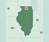
🥦 Food 49🏃 Movement 38🌿 Environment 72❤️ Health 28🏥 Healthcare 38
South Rockford posts health outcomes of 28.3 against an Illinois median of 61.3. Healthcare access 38.3 and walkability 38.1 both land well under the state. Food access and environment sit exactly at the Illinois medians — this card is decided entirely by health and by how hard it is to reach a doctor.
→Health outcomes 28.3 against an Illinois median of 61.3
→Healthcare access 38.3 and walkability 38.1, against state medians of 53.2 and 50.0
→Barely a bright spot: food access 49.3 and environment 72.0 both land exactly on the Illinois median
One more thing about RockfordThe sock monkey is a Rockford product. John Nelson, a Swedish immigrant, patented a sock-knitting machine here in 1868, and in 1932 his company added a red heel to its work socks purely so buyers could tell them from the competition. Crafters realized the red heel made a ready-made mouth, and the Rockford Red Heel became the standard sock monkey sock.Source: Midway Village Museum / Nelson Knitting
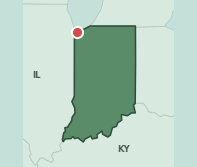
🥦 Food 78🏃 Movement 34🌿 Environment 57❤️ Health 2🏥 Healthcare 39
Gary’s health outcomes score is 1.8 — effectively the national floor — against an Indiana median of 32.6. The surprise is food access at 78.4 against a state median of 47.0, a 31-point advantage. Having stores nearby has not moved the health numbers.
→Health outcomes 1.8, near the national floor, against an Indiana median of 32.6
→Environment 57.2 against a state median of 75.0, and walkability 33.5 against 43.4
→Working in its favor: food access 78.4 against an Indiana median of 47.0 — a 31-point advantage the health numbers do not reflect
One more thing about GaryGary is a company town in the most literal sense: U.S. Steel laid it out in 1906 alongside its new works on the lakefront and named it for Elbert Gary, the chairman of the board. Sixty years later a family on Jackson Street sent out five brothers who became the Jackson 5. The steelworks are still running.Source: Britannica / Indiana Historical Society
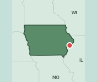
🥦 Food 41🏃 Movement 36🌿 Environment 14❤️ Health 36🏥 Healthcare 44
West Davenport carries the steepest environmental gap on this list: 14.3 against an Iowa median of 75.0, sixty points down. Health outcomes follow at 36.3 against 60.8. Every one of the five measures lands below the Iowa median, though walkability misses by only half a point.
→Environment 14.3 against an Iowa median of 75.0 — a 60.7-point gap, the steepest environmental deficit on this list
→Health outcomes 36.3 against a state median of 60.8
→No bright spot: all five measures sit below the Iowa median. Walkability, at 35.7 against 36.2, comes closest
One more thing about DavenportBix Beiderbecke was born in Davenport in 1903 and taught himself cornet by ear, never really learning to read music. He was dead at twenty-eight and is still regarded as one of the defining voices of 1920s jazz. He recorded a tune called Davenport Blues in 1925, and the city has run a jazz festival in his name for decades.Source: Bix Beiderbecke Museum / Quad Cities
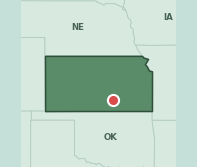
🥦 Food 17🏃 Movement 39🌿 Environment 72❤️ Health 11🏥 Healthcare 36
South Wichita posts health outcomes of 11.1 against a Kansas median of 56.2 and food access of 17.2 against 41.2. Nothing on this card clears the state median. It is the combination that produces a badge of 4 — a bad health picture and a thin grocery map in the same place.
→Health outcomes 11.1 against a Kansas median of 56.2 — a 45-point gap
→Food access 17.2 against a state median of 41.2
→No bright spot: every measure lands below the Kansas median. Walkability, 38.6 against 39.0, is the near miss
One more thing about WichitaTwo Wichita State students borrowed $600 from their mother in 1958 and opened a pizza place at 503 South Bluff. The sign only had room for eight letters after the word pizza, so they went with Hut. The original building sits on the Wichita State campus now as a museum.Source: Wichita State University, Pizza Hut Museum
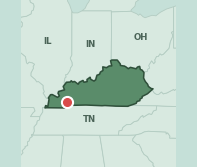
🥦 Food 15🏃 Movement 26🌿 Environment 75🏥 Healthcare 37
Kentucky has usable health outcomes data for only 3 of its 334 ZIP codes, so Cadiz cannot be placed in the national ranking and keeps its earlier score. What can be measured is bleak: food access 15.3 against a Kentucky median of 46.8, walkability 26.2 against 38.0, healthcare access 37.2 against 53.8.
→Food access 15.3 against a Kentucky median of 46.8 — about a third of the state’s typical score
→Healthcare access 37.2 and walkability 26.2, both well under the state medians of 53.8 and 38.0
→Why there is no rank line: health outcomes are missing for 331 of Kentucky’s 334 ZIP codes, so no merged score can be computed here
One more thing about CadizEvery October Cadiz bakes what it bills as the world’s largest country ham biscuit. Ten feet across, 200 pounds of dough before it goes in, 150 pounds of flour, 13 gallons of buttermilk, a forklift to get the pan into a custom oven, then 400 pounds of country ham. It feeds well over a thousand people.Source: Kentucky Living / Trigg County Country Ham Festival
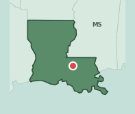
🥦 Food 54🏃 Movement 35🌿 Environment 58❤️ Health 0🏥 Healthcare 53
North Baton Rouge posts the lowest health outcomes score of any pick on this list: 0.5, against a Louisiana median that is itself only 11.6. Food access and healthcare access both clear the state median. The health number is so far down that little else on the card matters.
→Health outcomes 0.5 — the lowest of any pick on this list, against a Louisiana median of 11.6
→Environment 58.3 against a state median of 75.0
→Working in its favor: food access 53.8 against a Louisiana median of 43.4, and healthcare access 53.1 against 50.0
One more thing about Baton RougeThe city takes its name from a red pole. Iberville’s expedition came up the Mississippi in 1699 and noted a reddened cypress post the Bayougoula and Houma had set to divide their hunting grounds — le bâton rouge, a translation of the local Istrouma. The marker is said to have stood at Scott’s Bluff, in the north of the city near where Southern University is today.Source: Visit Baton Rouge / City of Baton Rouge
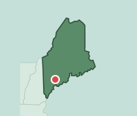
🥦 Food 55🏃 Movement 44🌿 Environment 96❤️ Health 33🏥 Healthcare 20
Sabattus is a small Androscoggin County town of 6,674 where healthcare access reads 20.3 against a Maine median of 50.0 — by a distance the sharpest gap on the card. Health outcomes are 32.8 against 52.0. The air is clean at 95.7, but Maine’s air is clean nearly everywhere.
→Healthcare access 20.3, against a Maine median of 50.0
→Health outcomes 32.8 against a state median of 52.0
→Barely a bright spot: environment 95.7 and food access 55.0 clear the Maine medians of 92.4 and 50.0, but only narrowly
One more thing about SabattusFor 131 years this town was called Webster. In 1971 it voted to rename itself Sabattus, after an eighteenth-century Anasagunticook chief whose name was already on the pond, the river and the mountain. The name itself is a corruption of Jean Baptiste, handed out by French missionaries as a baptismal name.Source: Town of Sabattus
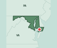
🥦 Food 54🏃 Movement 64🌿 Environment 75❤️ Health 16🏥 Healthcare 65
Princess Anne is an odd card: healthcare access 65.0, walkability 63.7 and food access 54.4 all clear the Maryland medians, and environment sits exactly at the state’s. Then health outcomes read 15.7 against 69.8 — a 54-point gap that overwhelms everything else on the card.
→Health outcomes 15.7 against a Maryland median of 69.8 — a 54-point gap
→Four of the five measures meet or beat the state median. Only health outcomes does not
→Working in its favor: healthcare access 65.0 against a Maryland median of 50.0
One more thing about Princess AnneThe town was laid out in 1733 and named for the daughter of George II. It is also home to the University of Maryland Eastern Shore, a historically Black land-grant university founded in 1886 as the Delaware Conference Academy, whose Frederick Douglass Library carries a mural of Douglass and Harriet Tubman — who was born about twenty-five miles up the road.Source: Town of Princess Anne / UMES
See why your ZIP code is better than Princess Anne
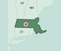
🥦 Food 34🏃 Movement 46🌿 Environment 42❤️ Health 44🏥 Healthcare 61
Ware is a former mill town in the Quabbin hills, and it trails Massachusetts on four of five measures. Environment reads 42.4 against a state median of 87.6, health outcomes 43.6 against 80.0, food access 33.5 against 55.0. Massachusetts sets a high bar, and Ware clears almost none of it.
→Environment 42.4 against a Massachusetts median of 87.6 — a 45-point gap
→Health outcomes 43.6 against 80.0, and food access 33.5 against 55.0
→Working in its favor: healthcare access 61.1, modestly above the state median of 57.7
One more thing about WareIn the mid-1930s the Otis Company, which had employed Ware for roughly a century, decided to shut its mills. The town bought them instead. Backed by the local trust company, residents formed Ware Industries and kept the works running — the first employee buy-out of a major American manufacturer. Ware spent years afterwards billed as the town that can’t be licked.Source: Town of Ware / WBUR
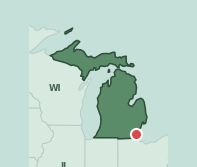
🥦 Food 31🏃 Movement 22🌿 Environment 99❤️ Health 24🏥 Healthcare 35
Newport sits on Lake Erie in Monroe County with an environment score of 98.8 against a Michigan median of 75.0, among the highest on this list. Everything else is under the state: walkability 22.0, health outcomes 23.5, food access 30.8, healthcare access 34.8. Clean air, and very little within reach of it.
→Walkability 22.0 against a Michigan median of 38.5 — among the lowest walkability scores on this list
→Health outcomes 23.5, food access 30.8 and healthcare access 34.8, all under the Michigan medians
→Working in its favor: environment 98.8 against a state median of 75.0
One more thing about NewportThe Enrico Fermi plant sits in Newport on the Lake Erie shore. On 5 October 1966 a piece of loose metal blocked the sodium coolant in Fermi 1 and two fuel assemblies began to melt. Nobody was hurt and no dangerous radiation escaped, but it produced a book called We Almost Lost Detroit, a Gil Scott-Heron song of the same name, and a rebuttal from the utility titled We Did Not Almost Lose Detroit.Source: Detroit Free Press / DTE Energy
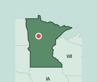
🥦 Food 64🏃 Movement 46🌿 Environment 75❤️ Health 66🏥 Healthcare 61
Park Rapids is the mildest card on this list. Health outcomes 66.3 against a Minnesota median of 69.5, walkability 45.6 against 47.2 — both a whisker under. Food access and healthcare access clear the state comfortably. It scores 24 nationally because Minnesota is healthy, not because Park Rapids is in trouble.
→Health outcomes 66.3, barely under the Minnesota median of 69.5
→Walkability 45.6 against a state median of 47.2 — the only other measure below the state
→Working in its favor: food access 64.4 and healthcare access 60.6, both more than ten points above the Minnesota medians of 50.0
One more thing about Park RapidsMain Street in Park Rapids has two rows of cars parked down the middle of it, which regularly stops visitors in their tracks. The street was made that wide for the long horse teams the logging trade needed, and the town simply kept the space and striped it for parking rather than giving it back.Source: Park Rapids Chamber / Visit Park Rapids
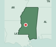
🥦 Food 35🏃 Movement 43🌿 Environment 62❤️ Health 2🏥 Healthcare 43
Northwest Jackson posts health outcomes of 2.2 against a Mississippi median of 17.8, itself among the lowest state medians here. Environment reads 61.7 against 75.0 and food access 34.9 against 39.8. Walkability is the single measure that clears the state.
→Health outcomes 2.2 against a Mississippi median of 17.8
→Environment 61.7 against a state median of 75.0
→Working in its favor: walkability 42.9 against a Mississippi median of 34.4 — the only measure above the state
One more thing about JacksonJackson bills itself as the City with Soul and has the blues markers to back it. Farish Street was for decades the center of Black business and social life in the city, and the Big Apple Inn on that street — still selling smoked sausage and pig ear sandwiches — was a regular meeting place for civil rights organizers and Freedom Riders.Source: Visit Jackson / Mississippi Blues Trail
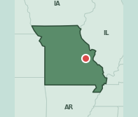
🥦 Food 25🏃 Movement 31🌿 Environment 75❤️ Health 18🏥 Healthcare 29
Saint Clair is a Franklin County town off I-44 where food access reads 25.0 against a Missouri median of 50.0 and healthcare access 28.7 against 50.0 — both roughly half the state’s typical score. Health outcomes are 18.1 against 29.0. Only environment, exactly at the state median of 75.0, holds level.
→Food access 25.0 and healthcare access 28.7, each about half the Missouri median of 50.0
→Walkability 31.0 against a state median of 46.0
→Barely a bright spot: environment 75.0, exactly the Missouri median — the only measure not below it
One more thing about Saint ClairThe town started life in 1843 as Traveler’s Repose, a thirteen-room stagecoach stop with a tavern and the post office, on the run between St. Louis and Springfield. When the railroad arrived in 1859 the name went — reportedly because Traveler’s Repose sounded rather too much like a cemetery — and it became St. Clair, after a railway engineer.Source: St. Clair History Museum / Franklin County
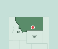
🥦 Food 41🏃 Movement 58🌿 Environment 82❤️ Health 52🏥 Healthcare 45
The Billings Heights are Montana’s lowest merged score, though none of the gaps are dramatic: health outcomes 52.3 against 62.7, food access 41.2 against 50.0, healthcare access 44.6 against 50.0. Environment and walkability both clear the state. It is a card of small deficits rather than one large one.
→Health outcomes 52.3 against a Montana median of 62.7
→Food access 41.2 and healthcare access 44.6, both under the state medians of 50.0
→Working in its favor: environment 82.2 against a Montana median of 75.0, and walkability 58.2 against 56.2
One more thing about BillingsThey call Billings the Magic City because of how fast it appeared. The Northern Pacific Railroad arrived in 1882 and a town went up on empty prairie so quickly that an officer wrote home that it had sprung up like a mushroom, overnight, like magic. The sandstone Rimrocks above it are considerably older.Source: Cat Country / Wikipedia
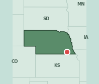
🥦 Food 32🏃 Movement 46🌿 Environment 92❤️ Health 52🏥 Healthcare 53
Beatrice sits in the Blue River valley an hour south of Lincoln. Health outcomes read 52.1 against a Nebraska median of 75.1, and food access 32.4 against 41.8. Environment is genuinely strong at 92.4 against 75.0 — which is why the badge lands at 33 rather than in the teens.
→Health outcomes 52.1 against a Nebraska median of 75.1 — a 23-point gap
→Food access 32.4 against a state median of 41.8
→Working in its favor: environment 92.4 against a Nebraska median of 75.0
One more thing about BeatriceThe Homestead Act took effect on 1 January 1863, and Daniel Freeman — a Union soldier home on leave who needed to get back to his regiment — talked the land office into opening on the holiday to take his claim. He is generally credited with the first homestead in the country. His 160 acres on Cub Creek, a few miles northwest of Beatrice, are now a National Park Service site.Source: National Park Service / Nebraska State Historical Society
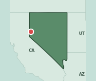
🥦 Food 67🏃 Movement 70🌿 Environment 9❤️ Health 24🏥 Healthcare 38
Sun Valley, just north of Reno, has the second-lowest environment score on this list — 9.4 against a Nevada median of 52.7. Health outcomes are 24.2 against 50.3. Food access and walkability both clear the state, which is unusual for a card scoring 12, and says how much the environment is costing it.
→Environment 9.4 against a Nevada median of 52.7 — the second-lowest environment score on this list
→Health outcomes 24.2 against a state median of 50.3, and healthcare access 38.1 against 54.7
→Working in its favor: food access 66.6 against a Nevada median of 50.0, and walkability 69.7 against 63.6
One more thing about Sun ValleySun Valley grew up in the 1960s as cheap housing on the far side of the hills from Reno, and it never incorporated. It is one of the larger unincorporated communities in Washoe County — a place of more than twenty thousand people with no mayor and no city council, joined to Reno by a single state highway.Source: Washoe County / Nevada State Route 443
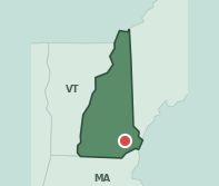
🥦 Food 40🏃 Movement 65🌿 Environment 85❤️ Health 59🏥 Healthcare 64
Raymond is New Hampshire’s lowest merged score at 42, which is a comment on New Hampshire. Health outcomes 58.7 against a state median of 80.5 is the real gap; food access 40.5 against 50.0 is the other. Walkability and healthcare access both clear the state by about fifteen points.
→Health outcomes 58.7 against a New Hampshire median of 80.5
→Food access 40.5 against a state median of 50.0
→Working in its favor: walkability 65.3 and healthcare access 64.0, each about fifteen points above the state medians of 50.0
One more thing about RaymondRaymond was originally called Freetown, and the name was literal: it was free of the usual obligation to reserve its tallest white pines for masts in the Royal Navy. Every other town in the province had to leave the best trees standing for the Crown. Raymond was set off from Chester as its own town in 1764.Source: Town of Raymond / Historic New England
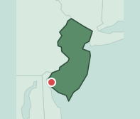
🥦 Food 32🏃 Movement 42🌿 Environment 25❤️ Health 26🏥 Healthcare 50
Salem carries the second-widest health gap on this list: 25.9 against a New Jersey median of 87.5, sixty-two points down. Nothing on this card clears the state. Food access 32.4 against 55.0, walkability 41.9 against 62.3, environment 25.0 against 34.7 in a state that scores poorly on environment to begin with.
→Health outcomes 25.9 against a New Jersey median of 87.5 — a 61.6-point gap, the second-widest on this list
→Food access 32.4 and walkability 41.9, against state medians of 55.0 and 62.3
→No bright spot: all five measures fall below the New Jersey median. Healthcare access, 50.5 against 57.0, comes closest
One more thing about SalemSalem tells a story about a colonel named Robert Gibbon Johnson who in 1820 stood on the courthouse steps and ate a whole basket of tomatoes to prove they would not kill him. Historians think he probably never did it, since the tale only shows up in print in the 1930s. The courthouse is real enough, built in 1735 and still the oldest working courthouse in New Jersey.Source: National Geographic / Encyclopedia of Food and Drink in America
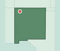
🥦 Food 33🏃 Movement 42🌿 Environment 62❤️ Health 18🏥 Healthcare 24
Bloomfield sits in the San Juan Basin and comes in under the New Mexico median on all five measures. Healthcare access 23.9 against 50.0 is the widest, health outcomes 17.6 against 39.5 next. Environment, 61.7 against a state median of 75.0, is the unusual one — most rural western picks score well there.
→Healthcare access 23.9, less than half the New Mexico median of 50.0
→Health outcomes 17.6 against a state median of 39.5, and food access 32.6 against 50.0
→No bright spot: every measure lands below the New Mexico median. Walkability, 42.2 against 50.0, is the narrowest miss
One more thing about BloomfieldOn the north bank of the San Juan just outside Bloomfield stands Salmon Ruins, a Chacoan great house of about 300 rooms raised around AD 1090 — forty-five miles from Chaco Canyon and built to the same plan. Local residents bought the site in 1969 to save it, and it was excavated through the 1970s.Source: San Juan County Museum Association / Salmon Ruins
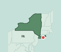
🥦 Food 55🏃 Movement 59🌿 Environment 85❤️ Health 47🏥 Healthcare 24
Mastic Beach, on the south shore of Long Island, posts healthcare access of 23.6 against a New York median of 55.2 — one of the widest healthcare gaps on this list. Health outcomes are 47.4 against 71.8. Food access sits exactly at the state median and the air is better than most of New York’s.
→Healthcare access 23.6 against a New York median of 55.2 — a 31.6-point gap
→Health outcomes 47.4 against a state median of 71.8
→Working in its favor: environment 84.7 against a New York median of 75.0, with food access and walkability essentially at the state median
One more thing about Mastic BeachMastic Beach was a village for barely seven years. Residents voted to incorporate in 2010, hoping tighter local code enforcement would deal with blight. By 2016, facing a road-paving overrun and the threat of a huge tax rise, they voted 1,922 to 1,215 to dissolve it again. It is one of the shortest-lived villages in New York history.Source: Long Island Press / CBS New York
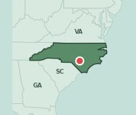
🥦 Food 41🏃 Movement 32🌿 Environment 14❤️ Health 26🏥 Healthcare 27
This Cumberland County ZIP outside Fayetteville is below the North Carolina median on every measure. Environment reads 14.3 against 64.3 — a fifty-point gap. Healthcare access 26.9 against 50.0 and health outcomes 25.6 against 43.9 complete a card with nothing to offset them.
→Environment 14.3 against a North Carolina median of 64.3 — a 50-point gap
→Healthcare access 26.9 and health outcomes 25.6, both roughly half the state medians
→No bright spot: all five measures sit below the North Carolina median. Walkability, 31.5 against 41.9, is the closest
One more thing about FayettevilleFayetteville was the first place in America named after the Marquis de Lafayette, in 1783, and the only one of the many Fayettevilles and Lafayettes that he ever actually visited. A friend gave him an engraving of the town’s State House; he was touched enough to add it to his 1825 grand tour and spent two days here.Source: NC Dept of Natural and Cultural Resources / The Lafayette Society
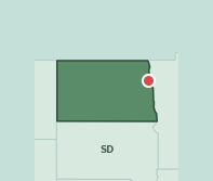
🥦 Food 85🏃 Movement 55🌿 Environment 75❤️ Health 67🏥 Healthcare 47
Grand Forks is North Dakota’s lowest merged score and the gaps are tiny: health outcomes 67.0 against 70.2, healthcare access 47.4 against 50.0. Food access is 84.7 against a state median of 50.0. At 43 it is one of the highest badges on this list, and it is there because North Dakota has no ZIP that scores badly.
→Health outcomes 67.0, barely under the North Dakota median of 70.2
→Healthcare access 47.4 against a state median of 50.0 — the only other measure below the state
→Working in its favor: food access 84.7 against a North Dakota median of 50.0, and walkability 54.6 against 46.1
One more thing about Grand ForksIn April 1997 the Red River rose over the defences and Grand Forks evacuated almost all of its 52,000 residents. Then, with several feet of water standing in the streets, a fire broke out downtown and burned eleven buildings across three blocks while firefighters waded in chest-deep to fight it. When the water fell, 82% of the city’s homes were damaged.Source: Grand Forks Herald / USGS
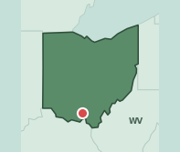
🥦 Food 70🏃 Movement 27🌿 Environment 80❤️ Health 7🏥 Healthcare 25
Lucasville is in Scioto County in southern Ohio, and its health outcomes score is 7.2 against a state median of 31.7. Healthcare access 25.1 and walkability 27.3 are both about half the state’s. Food access, 70.2 against 50.0, is strong — one of several cards here where groceries are close and the health numbers are still at the floor.
→Health outcomes 7.2 against an Ohio median of 31.7
→Healthcare access 25.1 and walkability 27.3, each roughly half the state medians of 50.0 and 48.0
→Working in its favor: food access 70.2 against an Ohio median of 50.0, and environment 79.8 against 66.0
One more thing about LucasvilleCaptain John Lucas platted Lucasville in 1819. His brother Robert went on to become a two-term governor of Ohio and then the first territorial governor of Iowa — a decent record for one family from a village in Scioto County. The town cemetery began as the Lucas family burying ground, with the first recorded burial in 1809.Source: Ohio Historical Markers / Lucasville Area Historical Society
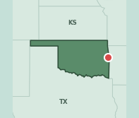
🥦 Food 45🏃 Movement 35🌿 Environment 69❤️ Health 6🏥 Healthcare 24
Muldrow sits on the Arkansas line in Sequoyah County and ranks 22nd from the bottom of all 18,356 scored ZIP codes. Healthcare access reads 23.5 against an Oklahoma median of 51.0, health outcomes 6.4 against 19.5. Environment is exactly at the state median; nothing else reaches it.
→22nd from the bottom nationally, out of 18,356 scored ZIP codes
→Healthcare access 23.5 against an Oklahoma median of 51.0, and health outcomes 6.4 against 19.5
→Barely a bright spot: environment 68.8, exactly the Oklahoma median — the only measure not below it
One more thing about MuldrowMuldrow got its post office in 1887 and its name from Henry Muldrow, then first assistant secretary of the Interior — a Mississippian who, as far as the record shows, had nothing to do with the place. The land had been Cherokee Nation since the Western Cherokee, the Old Settlers, moved in from Arkansas in 1829.Source: Oklahoma Historical Society
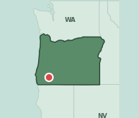
🥦 Food 30🏃 Movement 34🌿 Environment 77❤️ Health 22🏥 Healthcare 58
White City sits north of Medford in the Rogue Valley. Health outcomes 22.5 against an Oregon median of 50.5, walkability 33.7 against 54.3, food access 29.7 against 50.0. Even environment, at 77.3, falls well under Oregon’s median of 92.4 — a state where a high environment score is otherwise close to universal.
→Health outcomes 22.5 against an Oregon median of 50.5
→Walkability 33.7 and food access 29.7, both about twenty points under the state medians
→Working in its favor: healthcare access 58.5 against an Oregon median of 50.0 — the only measure above the state
One more thing about White CityFive days after Pearl Harbor, Congress voted $27 million to turn the Agate Desert into Camp White. At its peak the camp covered nearly 50,000 acres and held close to 40,000 people, which made it the second-largest city in Oregon. More than 110,000 troops passed through. The buildings became an industrial park, and in 1960 the place was renamed White City.Source: Oregon Encyclopedia
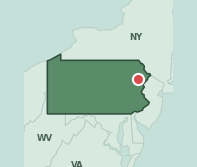
🥦 Food 89🏃 Movement 52🌿 Environment 42❤️ Health 27🏥 Healthcare 40
Tobyhanna sits in the Poconos with 17,000 residents and Pennsylvania’s weakest overall picture. Health outcomes read 27 against a state median of 50. The surroundings do it no favours either — the food mix, walkability and water together put it in the bottom tenth nationally.
→Health outcomes 27 against a Pennsylvania median of 50
→Bottom 10% nationally once food access, walkability and water are counted
→The core problem: a resort-belt population spread thin, with services to match
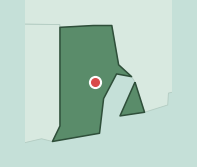
🥦 Food 59🏃 Movement 78🌿 Environment 46❤️ Health 44🏥 Healthcare 71
West Warwick is one of the most walkable picks on this list — 77.5 against a Rhode Island median of 64.8 — with healthcare access 71.3 and food access 59.3 also above the state. What drags it is environment at 45.7 against 84.7 and health outcomes at 44.5 against 74.0. At 50 it lands exactly at the national midpoint.
→Environment 45.7 against a Rhode Island median of 84.7 — a 39-point gap
→Health outcomes 44.5 against a state median of 74.0
→Working in its favor: walkability 77.5, healthcare access 71.3 and food access 59.3, all above the Rhode Island medians
One more thing about West WarwickWest Warwick is the youngest town in Rhode Island, split off from Warwick in 1913 — and it took the mills, the commercial district and most of the population with it. The Pawtuxet had been running mills here since 1677, and the Fruit of the Loom trademark started at the Royal Mill in the village of Pontiac.Source: Town of West Warwick / Rhode Island historical records
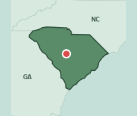
🥦 Food 50🏃 Movement 22🌿 Environment 25❤️ Health 13🏥 Healthcare 26
Gaston is in Lexington County south of Columbia and ranks 32nd from the bottom nationally. Environment reads 25.0 against a South Carolina median of 60.5, walkability 22.0 against 41.7 — among the lowest walkability scores on this list — and healthcare access 26.3 against 50.0.
→32nd from the bottom nationally, out of 18,356 scored ZIP codes
→Environment 25.0 against a South Carolina median of 60.5, and healthcare access 26.3 against 50.0
→Barely a bright spot: food access 50.2, two-tenths of a point above the state median of 50.0. Nothing else reaches it
One more thing about GastonGaston exists because a railway ran through it. The Savannah-to-Columbia line opened in 1891, a depot went up, and the railroad engineer named the place after his nephew. The town incorporated in 1894 and grew slowly until they paved US 321 through it.Source: Lexington County Chronicle
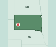
🥦 Food 49🏃 Movement 45🌿 Environment 40❤️ Health 70🏥 Healthcare 31
East Rapid City posts health outcomes of 69.8 — the highest of any pick on this list — barely under South Dakota’s median of 72.6. The problems are elsewhere: environment 40.4 against 75.0 and healthcare access 31.1 against 50.0. It scores 42 because the health picture is fine and the surroundings are not.
→Health outcomes 69.8 — the highest of any pick on this list, and only 2.8 under the South Dakota median
→Environment 40.4 against a state median of 75.0, and healthcare access 31.1 against 50.0
→Working in its favor: food access 49.4 against a South Dakota median of 32.9
One more thing about Rapid CityOn the night of 9 June 1972 fifteen inches of rain fell on the Black Hills in about six hours. Canyon Lake Dam clogged with debris and gave way just before eleven. The flood killed 238 people. Rapid City’s response was to stop building on the floodplain altogether and turn it into a greenway — more than 600 acres of park along Rapid Creek.Source: National Weather Service / USGS
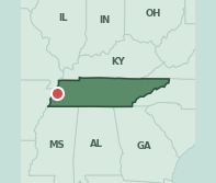
🥦 Food 26🏃 Movement 40🌿 Environment 75❤️ Health 3🏥 Healthcare 42
Ripley is in Lauderdale County in west Tennessee, and its health outcomes score is 2.6 against a state median of 14.4 — a low number measured against an already low bar. Food access is 26.5 against 40.5. Environment sits exactly at the state median and walkability just above it.
→Health outcomes 2.6 against a Tennessee median of 14.4
→Food access 26.5 against a state median of 40.5, and healthcare access 41.8 against 50.0
→Barely a bright spot: walkability 40.1 against a Tennessee median of 38.6, with environment exactly at the state’s 75.0
One more thing about RipleyLauderdale County has been holding a tomato festival in Ripley every July since 1984, complete with a tomato contest and Tomato Festival royalty, in honor of the roughly fifty growers who made the Ripley tomato a regional name. Alex Haley grew up in Henning, twelve miles down the road, in the house his grandfather built in 1919.Source: Lauderdale County / Alex Haley Museum
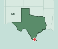
🥦 Food 55🏃 Movement 27🌿 Environment 55❤️ Health 6🏥 Healthcare 32
Edcouch, in Hidalgo County in the Rio Grande Valley, ranks 15th from the bottom of all 18,356 scored ZIP codes — the lowest-ranked pick on this list. Health outcomes read 5.7 against a Texas median of 37.5, walkability 26.8 against 50.0, healthcare access 32.3 against 50.0.
→15th from the bottom of all 18,356 scored ZIP codes — the lowest-ranked pick on this list
→Health outcomes 5.7 against a Texas median of 37.5, a 31.8-point gap
→Working in its favor: food access 55.0 against a Texas median of 50.0 — the only measure above the state
One more thing about EdcouchOn 14 November 1968 around 150 to 200 students walked out of Edcouch-Elsa High School over segregation and the treatment of Mexican American pupils, after the school board declined to act on their demands. It was the first major Chicano student walkout in South Texas. The town itself dates only to 1927 and is named for Edward Couch, a landowner and banker.Source: UTRGV Digital Exhibits / Texas State Historical Association
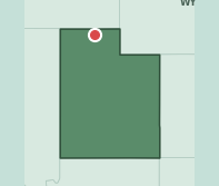
🥦 Food 22🏃 Movement 26🌿 Environment 63❤️ Health 63🏥 Healthcare 44
Tremonton is in Box Elder County north of Ogden, and it is under the Utah median on all five measures. Walkability 26.2 against 56.0 and food access 21.9 against 47.8 are the widest. Health outcomes, 62.7, would look respectable almost anywhere but Utah, where the median ZIP posts 79.8.
→Walkability 26.2 against a Utah median of 56.0, and food access 21.9 against 47.8
→Health outcomes 62.7 against a state median of 79.8
→No bright spot: every measure is below the Utah median. Environment, 63.1 against 64.3, misses by barely a point
One more thing about TremontonOn the morning of 2 July 1952, a US Navy chief photographer named Delbert Newhouse was driving his family past Tremonton when they stopped to film a cluster of objects overhead. His color footage went to the Air Force photo reconnaissance lab, which studied it for three months. It remains one of the most examined pieces of film in the Project Blue Book files.Source: Center for UFO Studies / Project Blue Book records
#14,122 unhealthiest ZIP code in America of 18,356
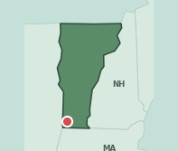
🥦 Food 88🏃 Movement 47🌿 Environment 90❤️ Health 52🏥 Healthcare 66
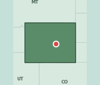
Bennington is the honest outlier on this list. It is Vermont’s lowest merged score and it still reads 76 — food access 87.7 against a state median of 50.0, environment 90.4 against 75.0, healthcare access 66.3 against 54.3. Health outcomes at 52.2 against 75.6 is the only real gap. Vermont has no ZIP that scores badly.
→Health outcomes 52.2 against a Vermont median of 75.6 — the only measure meaningfully below the state
→Food access 87.7 against a state median of 50.0, one of the widest food advantages on this list
→Why it is here anyway: at 76 this is comfortably the highest badge on the list. It is Vermont’s lowest merged score among ZIP codes over 10,000 people whose health outcomes fall below the state median — the state’s floor is simply that high
One more thing about BenningtonThe Bennington Battle Monument is 306 feet tall — the tallest structure in Vermont, and the second-tallest unreinforced masonry building in the country after the Washington Monument. It was dedicated in 1891 to mark the American victory of 16 August 1777, a battle that was fought over a supply depot at Bennington and mostly took place across the state line in New York.Source: Vermont State Historic Sites / American Battlefield Trust
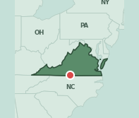
🥦 Food 58🏃 Movement 57🌿 Environment 25❤️ Health 8🏥 Healthcare 59
Danville is a striking split. Healthcare access 59.0, food access 58.3 and walkability 57.4 all clear the Virginia medians. Then environment reads 25.0 against 75.0 and health outcomes 7.8 against 46.0. A town with the services in place and the health numbers of somewhere with none of them.
→Environment 25.0 against a Virginia median of 75.0 — a 50-point gap
→Health outcomes 7.8 against a state median of 46.0
→Working in its favor: healthcare access 59.0, food access 58.3 and walkability 57.4, all above the Virginia medians
One more thing about DanvilleWhen the Confederate government abandoned Richmond on 2 April 1865, it moved to Danville. Jefferson Davis spent the week of 3 to 10 April in the Sutherlin house on Main Street, wrote his last proclamation there and held his final cabinet meeting, then left by train when word came that Lee had surrendered. The house is a museum now.Source: Virginia Dept of Historic Resources / American Battlefield Trust
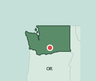
🥦 Food 82🏃 Movement 32🌿 Environment 88❤️ Health 24🏥 Healthcare 33
Wapato is in the Yakima Valley, and it splits hard. Food access 81.7 against a Washington median of 50.0 and environment 87.6 against 77.3 are both well clear. Health outcomes 23.5 against 69.1 and walkability 32.2 against 64.0 are both far under. The result is a badge of 10.
→Health outcomes 23.5 against a Washington median of 69.1 — a 45.6-point gap
→Walkability 32.2 against a state median of 64.0
→Working in its favor: food access 81.7 against a Washington median of 50.0, and environment 87.6 against 77.3
One more thing about WapatoThe town is named for wapato, the arrowhead tuber that grew through the valley and was a staple food long before the orchards arrived. William Clark thought it was equal to the Irish potato and a tolerable substitute for bread. The place was a railway stop called Simcoe until 1903, when it took the name to stop being confused with Fort Simcoe.Source: HistoryLink / Yakima Herald-Republic
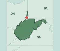
🥦 Food 86🏃 Movement 44🌿 Environment 82❤️ Health 5🏥 Healthcare 44
Moundsville has the widest food access advantage on this list — 86.4 against a West Virginia median of 43.1 — and it barely registers. Health outcomes read 4.8, and West Virginia’s own median is 6.1, the lowest of any state here. The whole state sits at the floor on health, and Moundsville is at the floor of the floor.
→Food access 86.4 against a West Virginia median of 43.1 — the widest food advantage on this list
→Health outcomes 4.8, against a state median of 6.1 that is itself the lowest here
→Working in its favor: food access and environment both clear the state comfortably. Neither has moved the health numbers
One more thing about MoundsvilleThe town is named for the Grave Creek Mound, a conical Adena burial mound raised between about 250 and 150 BC out of some 57,000 tons of earth. It is 62 feet high and the largest of its kind in North America. In 1866 the state began building its penitentiary directly across the street from it; the prison ran until 1995 and now gives tours.Source: e-WV: The West Virginia Encyclopedia / National Park Service
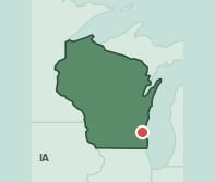
🥦 Food 41🏃 Movement 52🌿 Environment 72❤️ Health 21🏥 Healthcare 34
Northwest Milwaukee posts health outcomes of 20.8 against a Wisconsin median of 57.7 — a 37-point gap — and healthcare access 33.7 against 50.0. Walkability is the one measure above the state, at 51.6 against 42.6. Food access and environment both sit modestly under.
→Health outcomes 20.8 against a Wisconsin median of 57.7 — a 37-point gap
→Healthcare access 33.7, two-thirds of the state median of 50.0
→Working in its favor: walkability 51.6 against a Wisconsin median of 42.6 — the only measure above the state
One more thing about MilwaukeeMilwaukee was three rival towns on two banks of a river, and in 1845 they came to blows over a bridge. West-siders tore out their half of the Chestnut Street crossing; east-siders answered by destroying the Wisconsin Avenue bridge. Nobody died. The three settlements merged into a single city the following January, which is why the street grids on either side of the river still do not line up.Source: Encyclopedia of Milwaukee / Milwaukee City Clerk
🥦 Food 42🏃 Movement 36🌿 Environment 72❤️ Health 62🏥 Healthcare 41
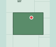
West Casper is Wyoming’s lowest merged score and the card is remarkably flat. Health outcomes 61.7 sit essentially at the state median of 62.3. Walkability 35.7 against 47.1 is the widest gap on the card. Nothing here is badly wrong — Wyoming’s range is just narrow.
→Health outcomes 61.7, within a point of the Wyoming median of 62.3
→Walkability 35.7 against a state median of 47.1, and healthcare access 41.0 against 50.0
→Barely a bright spot: food access 42.2 against a Wyoming median of 40.6 — the only measure above the state, and only just
One more thing about CasperThe Salt Creek field north of Casper was one of the biggest oil producers in the world in the 1920s, and the naval reserve beside it was named Teapot Dome for a sandstone rock shaped like a teapot. Interior Secretary Albert Fall leased it out in exchange for bribes, and became the first American cabinet officer to go to prison for crimes committed in office.Source: WyoHistory.org
Health outcomes — CDC PLACES 2025, ZCTA release (chronic disease and preventable hospitalisation prevalence, modelled small-area estimates for adults)
Food access — USDA, OpenStreetMap and Overture retail locations, plus measured chain foot traffic
Movement — EPA National Walkability Index (1–20), parks and fitness locations
Environment — EPA air monitoring (annual PM2.5 against the federal limit of 9.0 µg/m³), EPA UCMR5 drinking-water sampling, EPA Superfund NPL, FEMA disaster declarations
Healthcare access — HRSA, NPPES and hospital location files
Population — U.S. Census ACS
Scope — 18,356 residential ZIP codes carrying a complete merged score. Non-residential, institutional and military ZIP codes excluded. Population floor of 10,000 residents for the picks on this list, relaxed to 5,000 in Maine, where no ZIP above 10,000 scores in the lower half of the state.
Weights — the score on each badge is health outcomes 30%, healthcare access 20%, and the Neighborhood Wellness Score percentile 50%. That percentile is itself food and retail mix 45%, walkability 25%, air quality 20% and tap water 10%.
Known gap — the 2025 CDC PLACES ZCTA release carries no chronic-disease data for Pennsylvania and almost none for Kentucky, so neither state can be given a merged score. Both cards keep their earlier four-measure score and carry no national rank line.
Cory Jones has spent 20 years in media and publishing and now leads the data and editorial operation behind The Greenest. He built and maintains the site’s Neighborhood Wellness Score — a proprietary dataset scoring food access, walkability, air quality, healthcare access, and health outcomes across 18,356 U.S. ZIP codes, drawing on CDC PLACES data, EPA air quality readings, and verified location intelligence. He turned 50 last year, is a huge fan of Rancho Gordo beans, and tries to work out more than he actually works out.
The Greenest Wellness Score
Is your neighborhood healthy?
Get a free report on your tap water, air quality, walkability and more
Thanks! We’ve queued this article to your inbox. Check your email shortly.
Thanks! We’ve queued this article to your inbox. Check your email shortly.
Manage Consent
To provide the best experiences, we use technologies like cookies to store and/or access device information. Consenting to these technologies will allow us to process data such as browsing behavior or unique IDs on this site. Not consenting or withdrawing consent, may adversely affect certain features and functions.
Functional
Always active
The technical storage or access is strictly necessary for the legitimate purpose of enabling the use of a specific service explicitly requested by the subscriber or user, or for the sole purpose of carrying out the transmission of a communication over an electronic communications network.
Preferences
The technical storage or access is necessary for the legitimate purpose of storing preferences that are not requested by the subscriber or user.
Statistics
The technical storage or access that is used exclusively for statistical purposes.The technical storage or access that is used exclusively for anonymous statistical purposes. Without a subpoena, voluntary compliance on the part of your Internet Service Provider, or additional records from a third party, information stored or retrieved for this purpose alone cannot usually be used to identify you.
Marketing
The technical storage or access is required to create user profiles to send advertising, or to track the user on a website or across several websites for similar marketing purposes.